Appendix A

Special Manhattanville Mixed Use District Plan

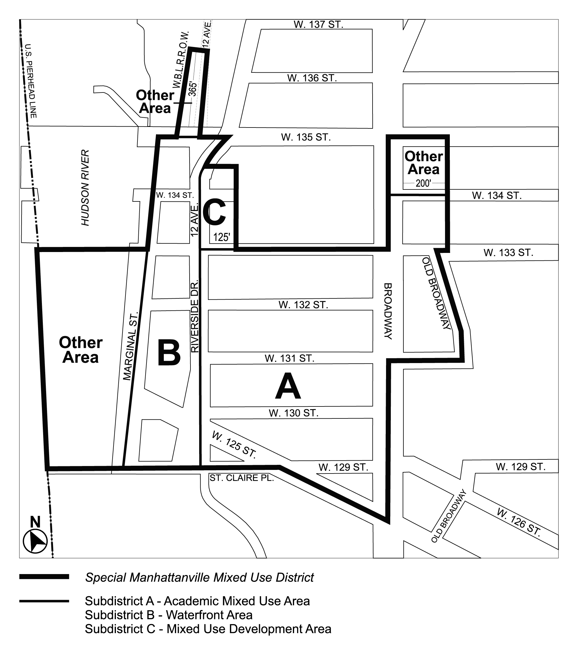
Map 1 - Special Manhattanville Mixed Use District and Subdistricts (10/23/24)

ARTICLE X, Chapter 4, Appendix A: Special Manhattanville Mixed Use District Plan, Map 1 (" Special Manhattanville Mixed Use District and Subdistricts") amended per 135th Street Rezoning (N 230207 ZRM), adopted 23rd October, 2024


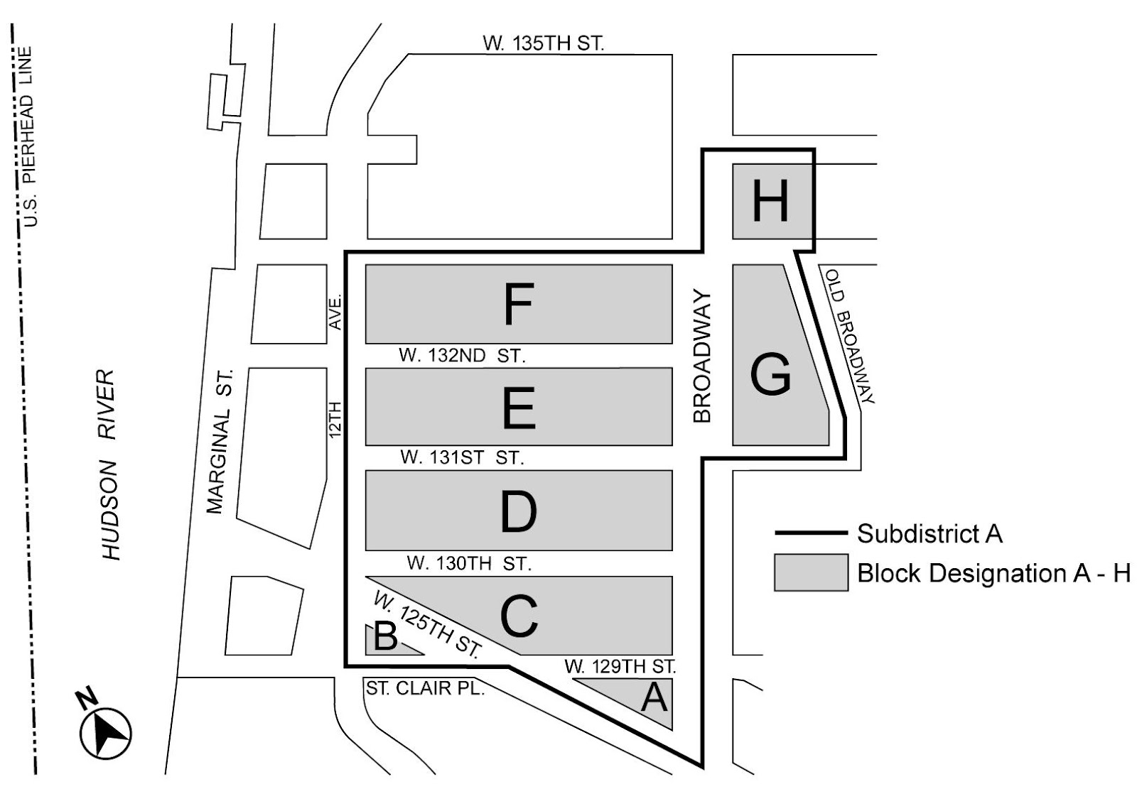
Map 2 - Subdistrict A Block Plan (12/19/07)

Zoning Resolutions Chapter 4: Special Manhattanville Mixed Use District Appendix A.1


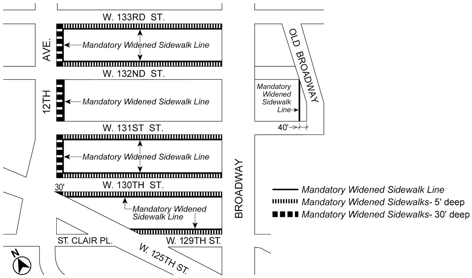
Map 3 - Widened Sidewalk Lines (12/19/07)

Zoning Resolutions Chapter 4: Special Manhattanville Mixed Use District Appendix A.2


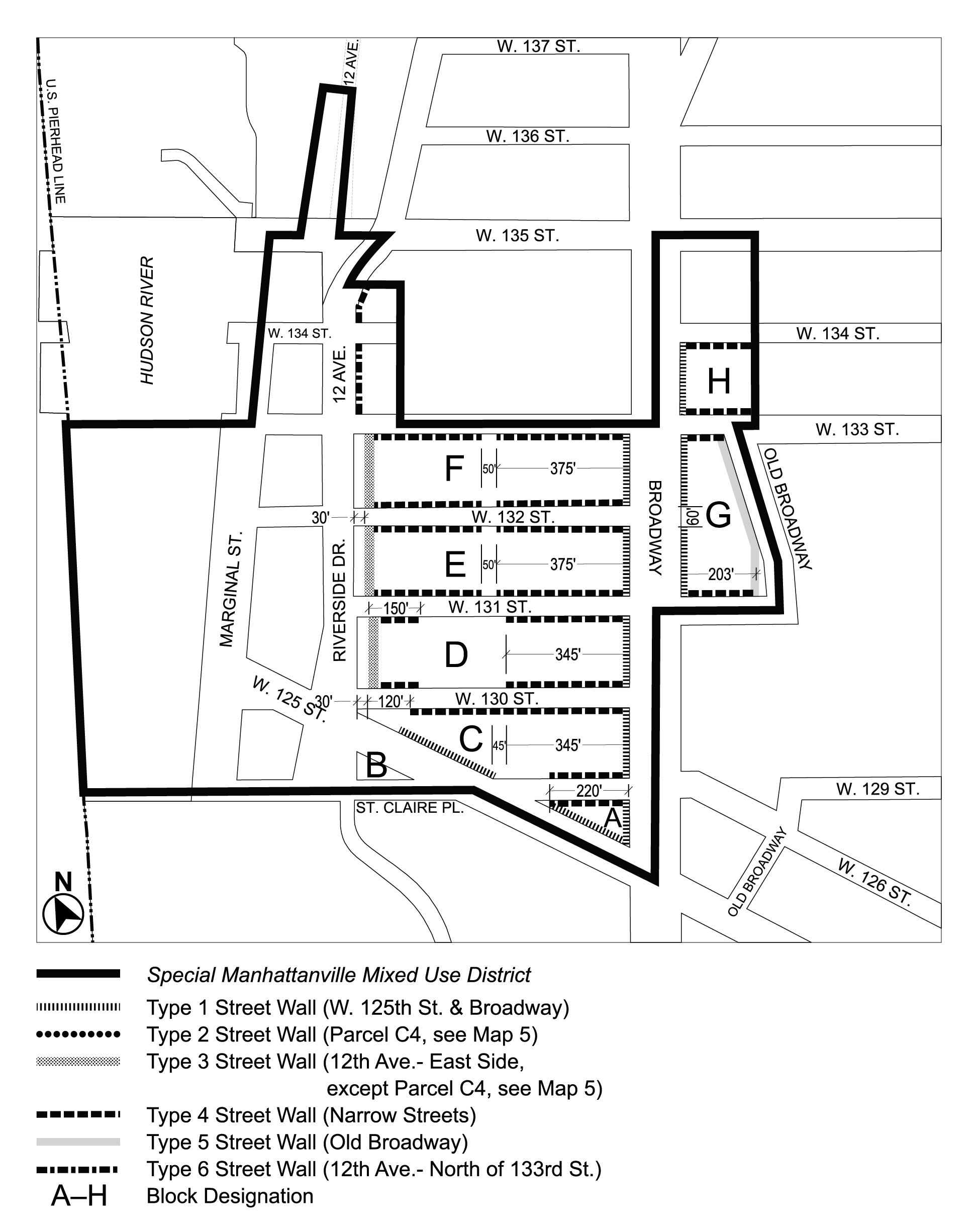
Map 4 - Street Wall Types and Locations (10/23/24) 

ARTICLE X, Chapter 4, Appendix A: Special Manhattanville Mixed Use District Plan, Map 4 ("Street Wall Types and Locations") amended per 135th Street Rezoning (N 230207 ZRM), adopted 23rd October, 2024


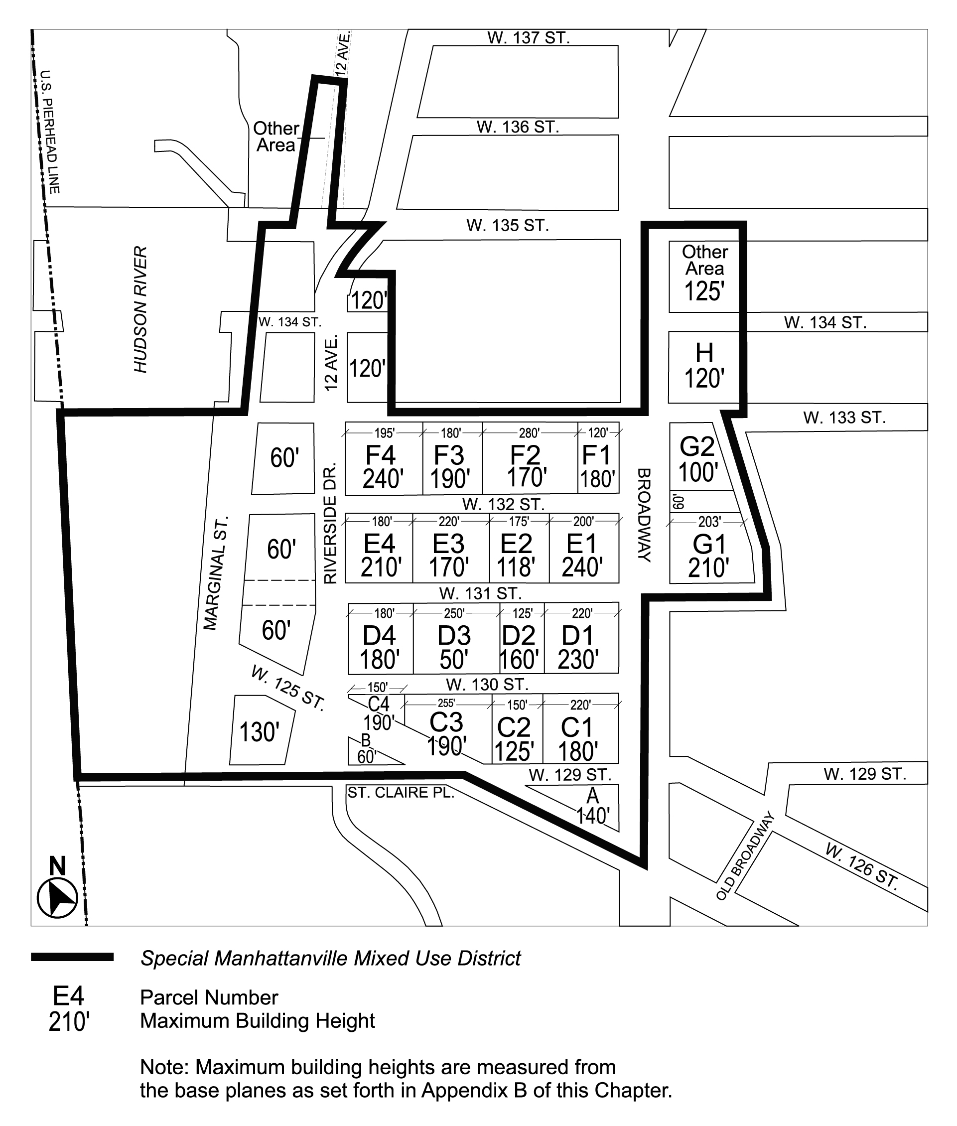
Map 5 - Parcel Designation and Maximum Building Heights (10/23/24) 

ARTICLE X, Chapter 4, Appendix A: Special Manhattanville Mixed Use District Plan, Map 5 ("Parcel Designation and Maximum Building Heights") amended per 135th Street Rezoning (N 230207 ZRM), adopted 23rd October, 2024


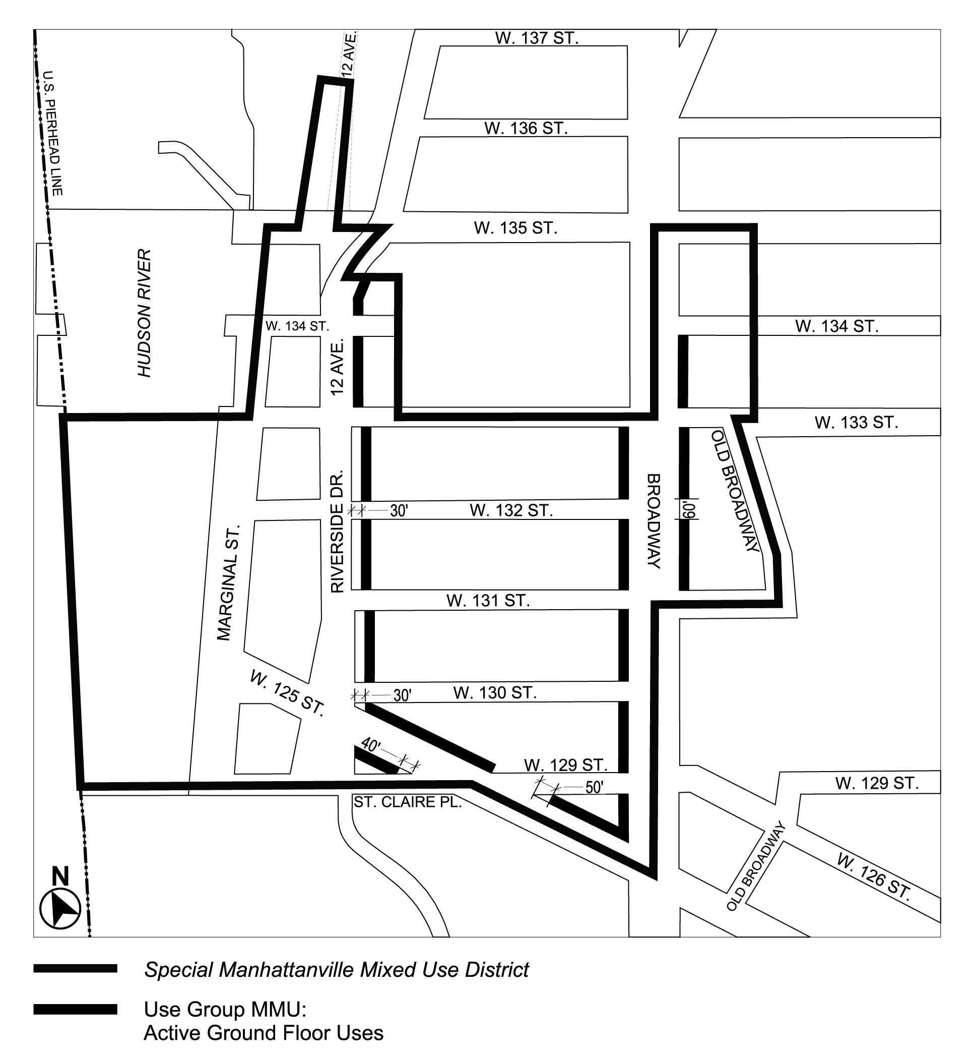
Map 6 - Ground Floor Use and Frontage (10/23/24)

ARTICLE X, Chapter 4, Appendix A: Special Manhattanville Mixed Use District Plan, Map 6 ("Ground Floor Use and Frontage") amended per 135th Street Rezoning (N 230207 ZRM), adopted 23rd October, 2024


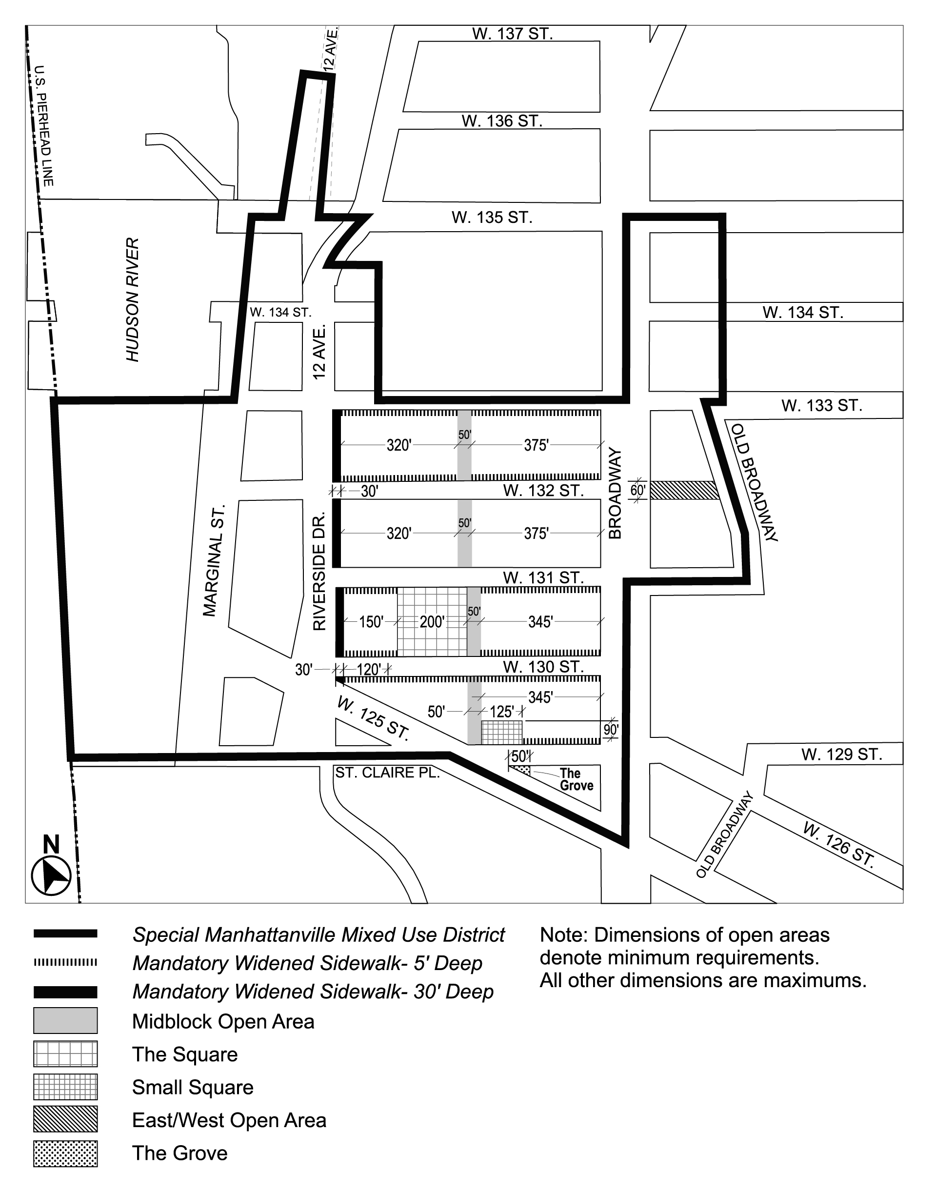
Map 7 - Mandatory Open Areas (10/23/24)

ARTICLE X, Chapter 4, Appendix A: Special Manhattanville Mixed Use District Plan, Map 7 ("Mandatory Open Areas") amended per 135th Street Rezoning (N 230207 ZRM), adopted 23rd October, 2024


Top