Appendix A
Special Southern Hunters Point District Plan
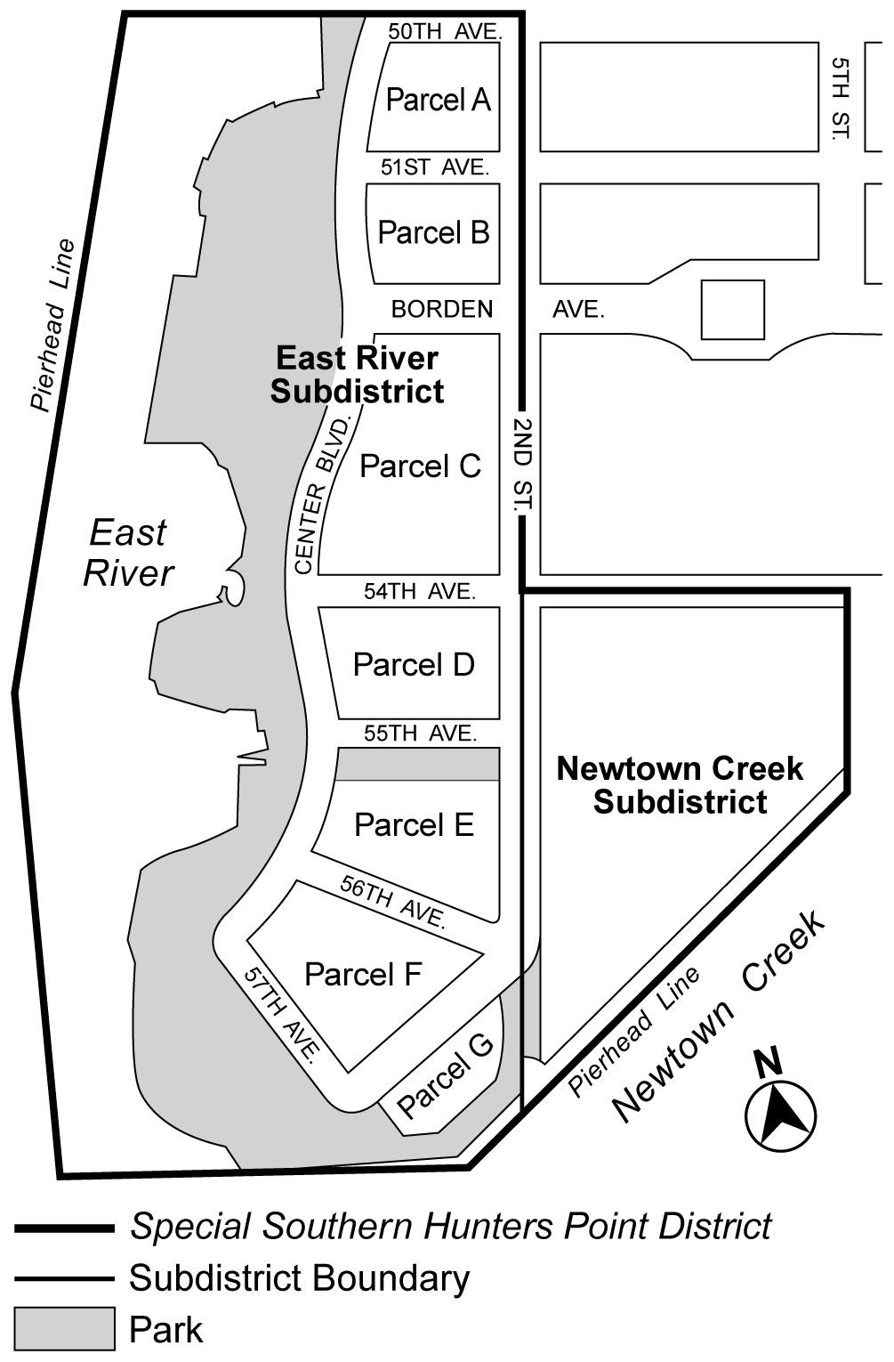
Map 1 – Special Southern Hunters Point District, Subdistricts and Parcels
Map 2 – Special Ground Floor Use Regulations
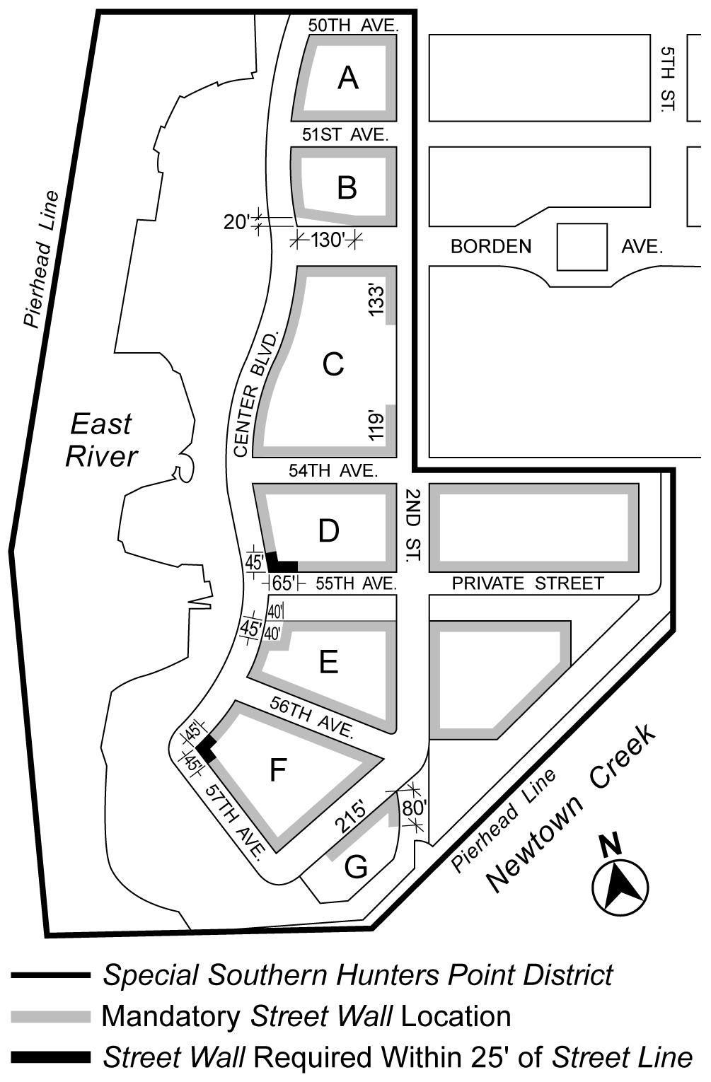
Map 3 – Street Wall Locations
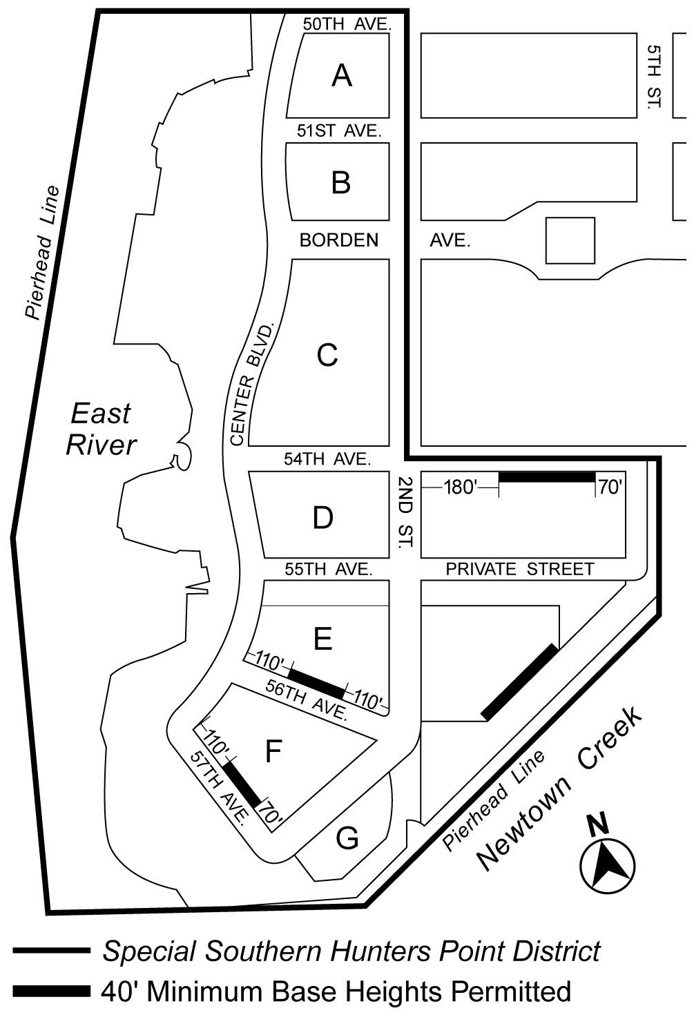
Map 4 – Minimum Base Heights of 40 Feet
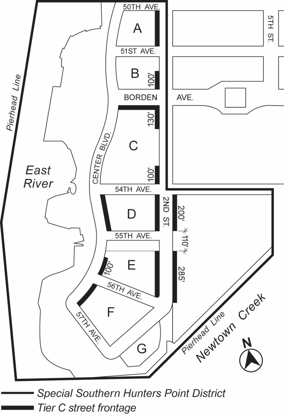
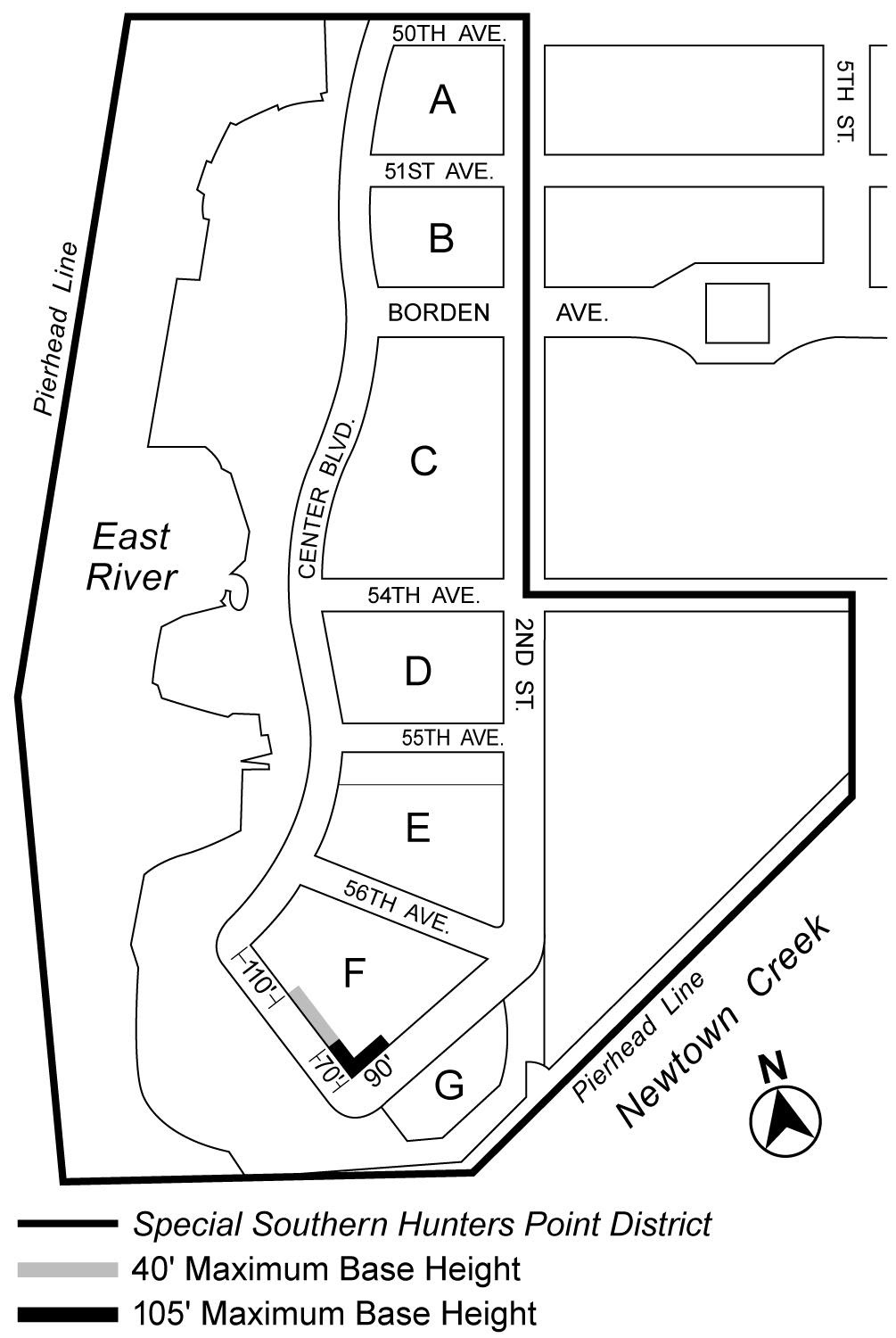
Map 5 – Maximum Base Heights other than 70 Feet
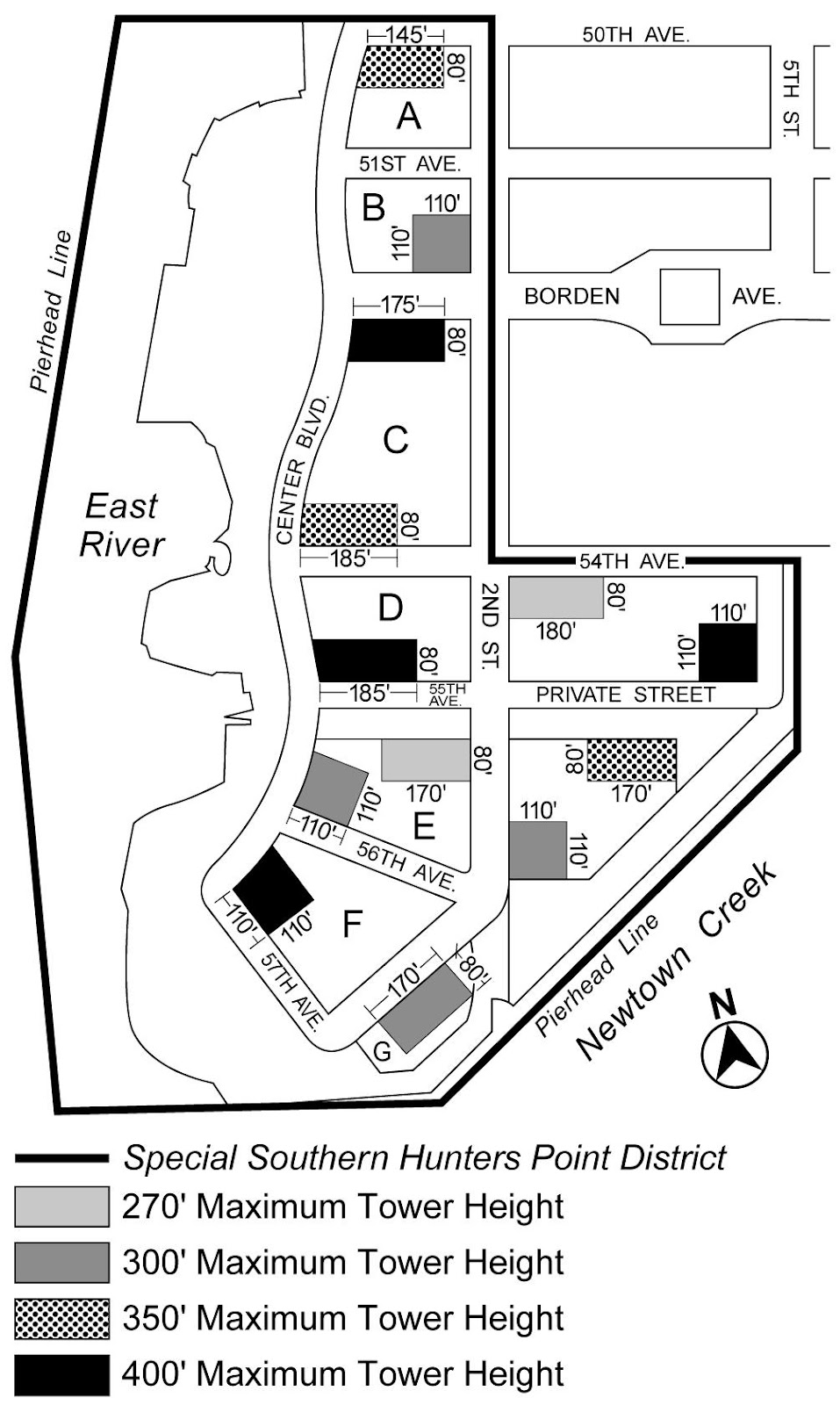
Map 6 – Tower Areas
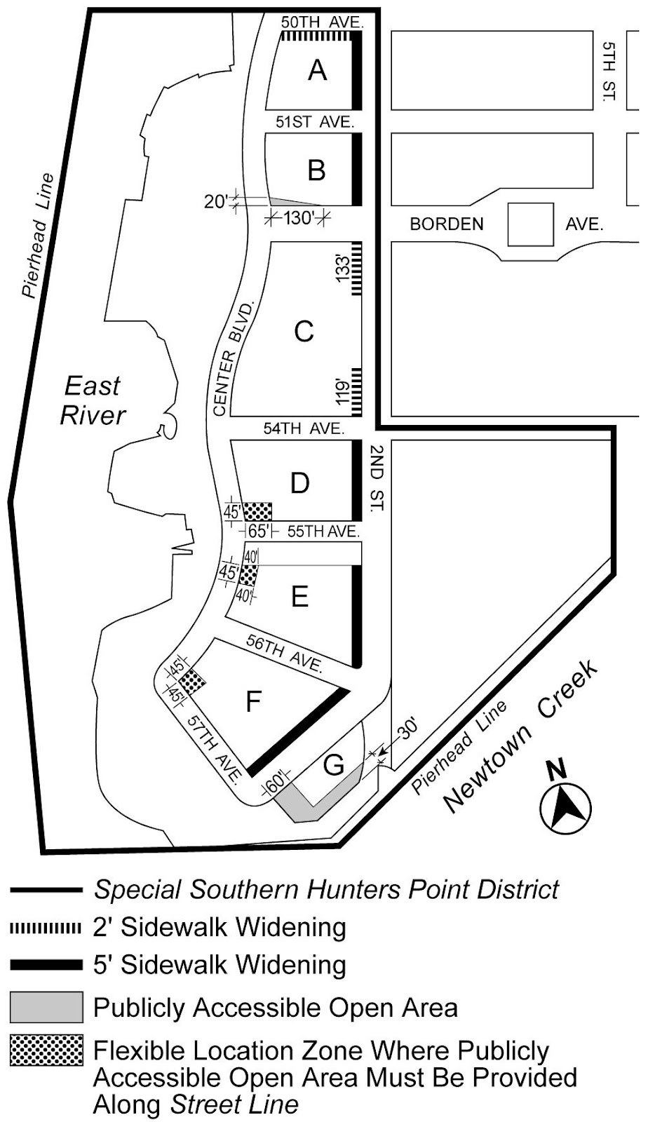
Map 7 – Mandatory Sidewalk Widenings and Publicly Accessible Open Area
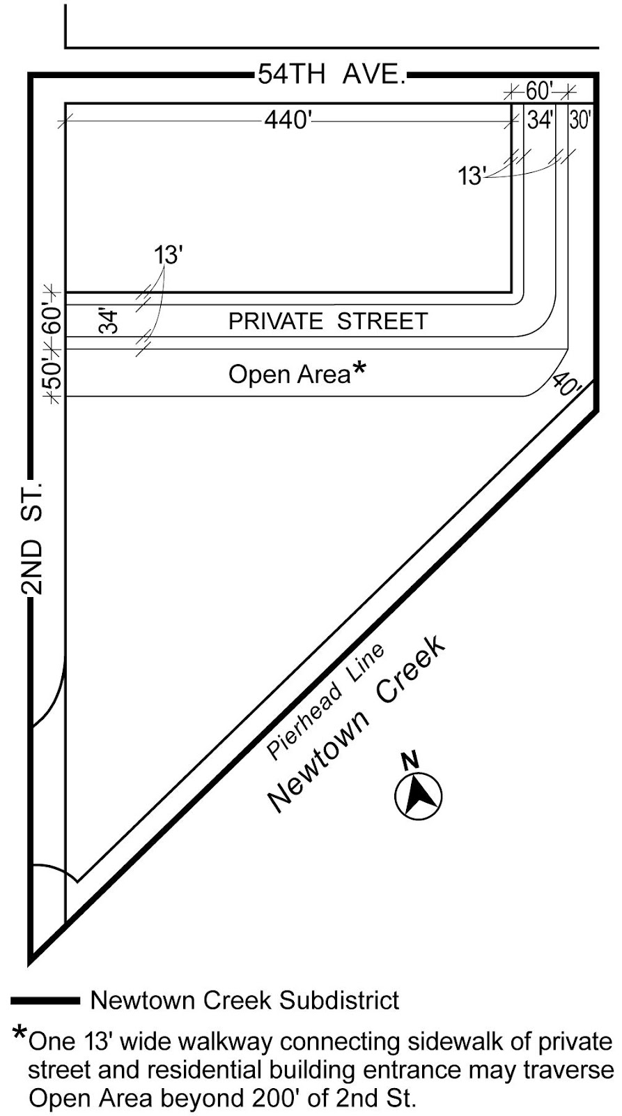
Map 8 – Publicly Accessible Private Street and Open Area in Newtown Creek Subdistrict
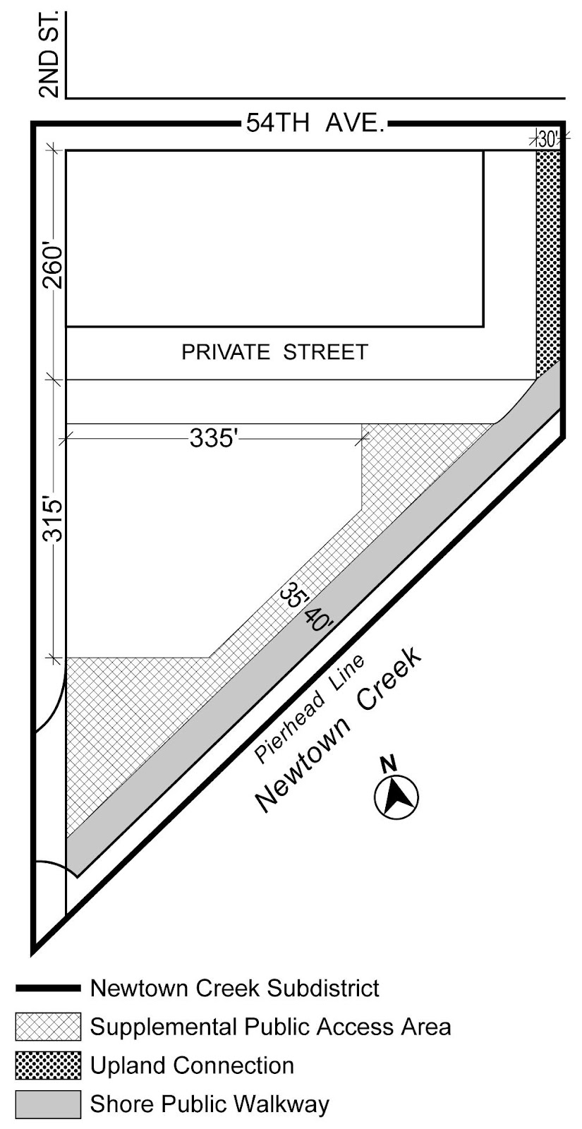
Map 9 – Newtown Creek Waterfront Access Plan (Q-3)
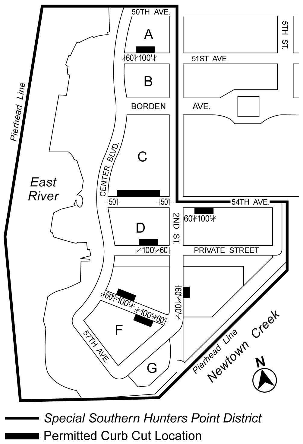
Map 10 – Permitted Curb Cut Locations